
Historical Oasis / Kaloko Honokohau
Historical Oasis
Take a step back in time at Kaloko-Honokōhau National Historical Park
By Brooke Rehmann
Kaloko-Honokōhau National Historical Park sits on what appears to be very inhospitable land. Surrounded by black lava, arid,warm air with the unrelenting sun beating down, a person may reasonably survey their surroundings and think this would not feel like an ideal place to live before modern amenities such as air conditioning and refrigeration. And yet, this area supported a thriving community, using ingenious fishing and land management techniques, techniques that might appear modern and enlightened by today’s standards.
Standing in the park, though, it’s easy to use your imagination to step back in time, and see the land from the vantage point of the Kānaka Maoli, or Native Hawaiians. With its shallow shores and gentle landing areas for wa‘a, or canoes, Hawaiians could easily fish and enjoy recreation from the area. As you wander around the greater Kona coastline, you might notice the rocky shoreline and few easily accessible beaches. Hence, Kaloko-Honokōhau was a respite from these challenges. The climate, though warm and parched, was pleasant enough with the right materials at hand to create simple dwellings that protected from periods of harsher weather. Kaloko-Honokōhau also had access to an abundance of medicinal and functional plants and other foodstuffs, including noni and ‘ilima for medical use, and pili grass to help construct housing structures. The fishing included species such as aku (skipjack) and ‘ōpelu (mackerel) as well as a modern day favorite, ‘ahi (yellow fin tuna). The area also included access to brackish water springs, which indicated fresh water could be found to support enough of a population in this dry corner of the island. This water could also help support the growth of edible crops grown in small enclosures in the ‘a‘a lava fields. It is no surprise, then, that what might initially appear to be inhospitable was actually an ideal setting.
The park is also one of the Big Island’s best-kept secrets, except it’s not very secret or particularly hidden. Located along the Queen Ka‘ahumanu Highway between the airport and downtown Kailua-Kona with its own traffic signal, you really can’t miss it. And yet, a trip to the park feels like you found a place that very few people know of, with its incredible beach and interesting landmarks it is sparsely populated, even on a weekend. Receiving about 10% of the total visitors to Hawai‘i Volcanoes National Park, a trip to Kaloko-Honokōhau National Historical Park is an opportunity for visitors to truly get a sense of what our islands’ shores were like in the not-so-distant past.
It is theorized that Kaloko-Honokōhau was initially settled between A.D. 900 to 1000 and inhabited and worked well into the late 20th century. The population fluctuated over the years with evidence suggesting it supported around 200 and up to 400 people at certain times, though more recently the number was much lower. When the Hawaiian ali‘i, or royalty, began to live along these shores, food production increased, leading to the ability to support larger amounts of people.
Ali‘i and high chiefs were drawn not just to the spirituality of the area, but for another major reason —its fishponds. The park features three fishponds, each a distinctive type serving a different purpose. Back in the days before Western contact, the Hawaiians utilized a land resource management system of ahupua‘a, a land division system of wedge shaped slices of land that run from high up the volcano slopes all the way down to the sea. This allowed communities to have access to various plants, animals, and other useful materials across geographically diverse areas. Fishponds allowed the Hawaiians to manage the fish population, capturing the fish in their early stages, and allowing them to grow to the perfect size for consumption. They were also kapu, or taboo, which kept the ponds from being overfished. Interestingly, residents of one ahupua‘a would generally only have contact with members of their own community, and not necessarily their neighbors, even if they lived closed by along the shoreline (or farther up the mountain). The park contains five ahupua‘a, three of which contain fishponds. As you visit each fishpond, it’s fascinating to imagine how life might have been in those days using this land division system.
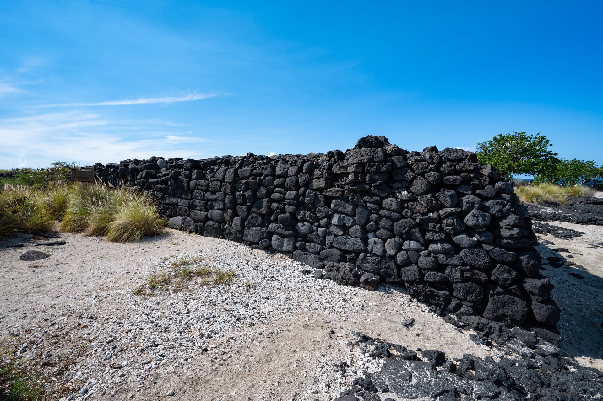
Starting at the northern portion of the park, we find Kaloko Fishpond. (Incidentally, the word “Kaloko,” which is also the name of its ahupua‘a, means “fishpond”). Visitors who drive down the bumpy road from the highway eventually end up at this large pond that features a rock wall with some original components still in place. This style of fishpond, or loko kuapā, utilizes stones that are stacked without mortar, and angled in such a way to prevent the waves from knocking them over. Over the years, the rock wall has been rebuilt several times including more modern techniques, but it has been found that the original native Hawaiian rock building techniques can actually withstand the elements better. The rock wall also features a sluice gate, which allows the fish in, but prevents them from leaving as the tides changed, creating the perfect method for managing fish resources.
Heiau
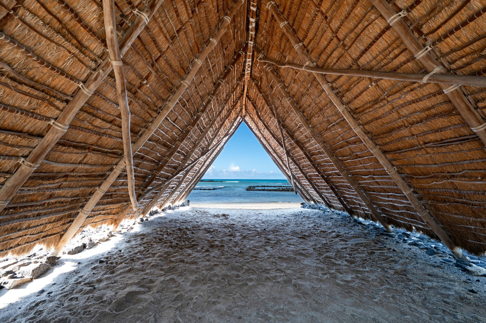
Canoe House
AiopioFishtrapArea
AiopioFishtrap
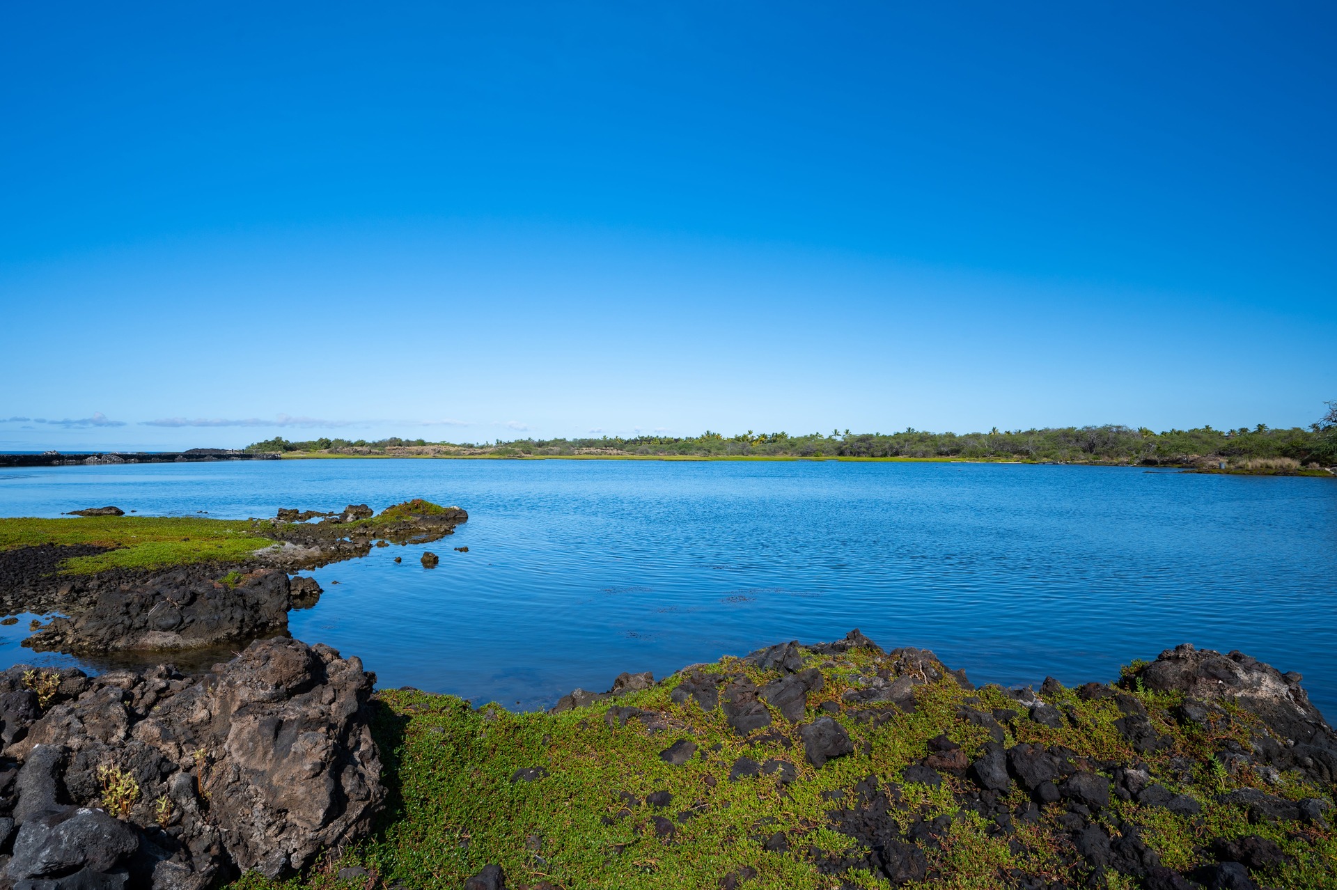
Kaloko Fishpond
KingsHighway
Petrtoglyphs
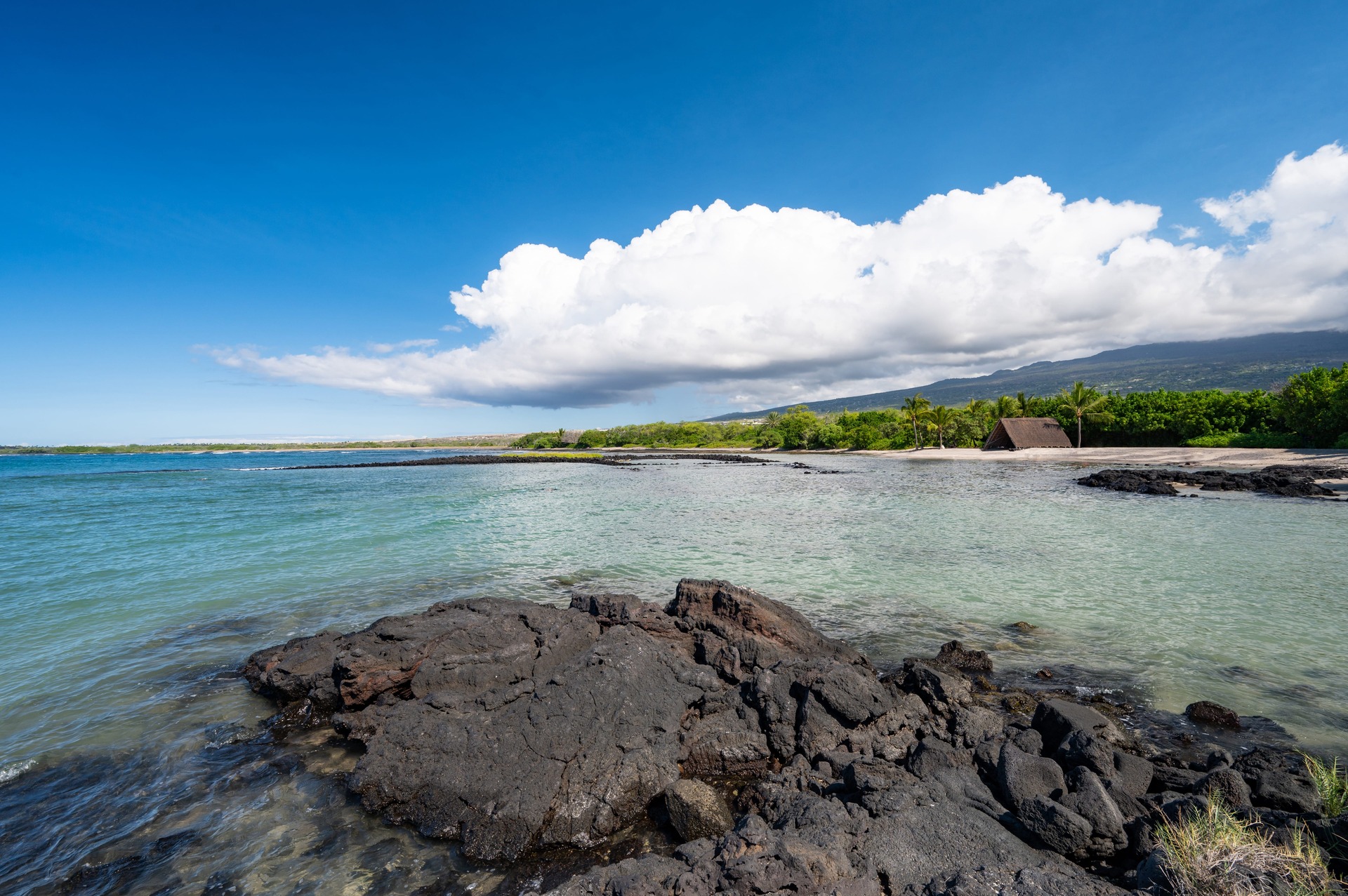
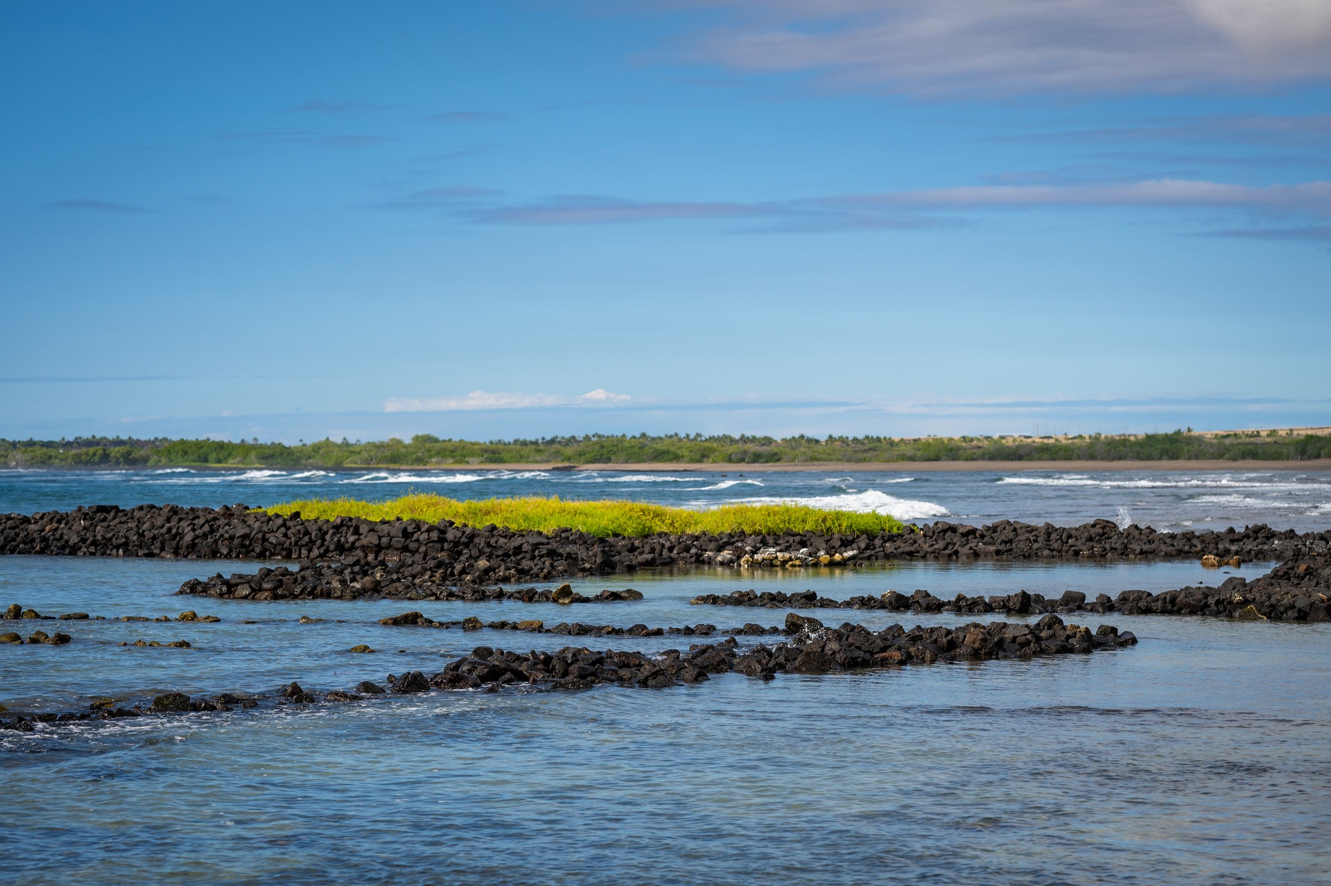
Also within the park are two other fishponds, including ‘Aimakapā Fishpond and ‘Ai‘ōpio Fishtrap. ‘Aimakapā Fishpond, located in the center of the park, is a lagoon that was created behind a beach barrier, known as a loko pu‘uone. Though it formed naturally, the pond was used by Hawaiians for aquaculture until the 1950s. Farther south along the beach is ‘Ai‘ōpio Fishtrap, the only of its kind on the entire island. The trap, or loko ‘ume iki, was created using natural features, such as a rocky shoreline, with a manmade seawall that swept around to encircle the sandy beach area. Fish would be trapped during the high tide, and perhaps moved into the four square holding pens you can still see submerged near the shoreline. The setting at ‘Ai‘ōpio is certainly one of the most beautiful on the island, with its calm, turquoise waters, honu, or Hawaiian Green Sea Turtles, nesting along the shoreline, as well as a Hālau wa‘a, or canoe house, nearby.
It is here at ‘Ai‘ōpio where we can also find one of the park’s most significant heiau, or temple. Pu‘u‘oina Heiau is an example of a platform heiau, and the best example of such a structure in Kona. This heiau still commands reverence and respect, as visitors are asked to avoid using the space for recreation, and instead approach it with the same mindset one might use at a church or synagogue. Looking at the structure, one can imagine the amount of effort it would have taken to build, requiring someone with enough power to command the manpower to lug the massive volcanic rocks into place.
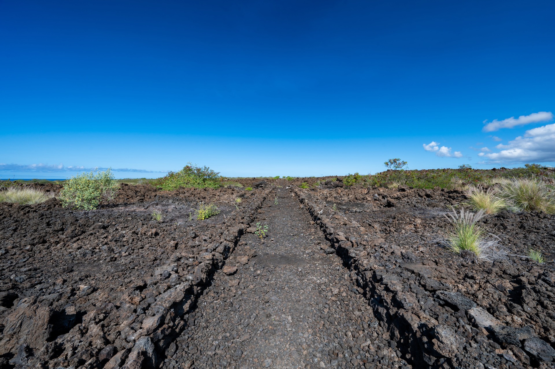
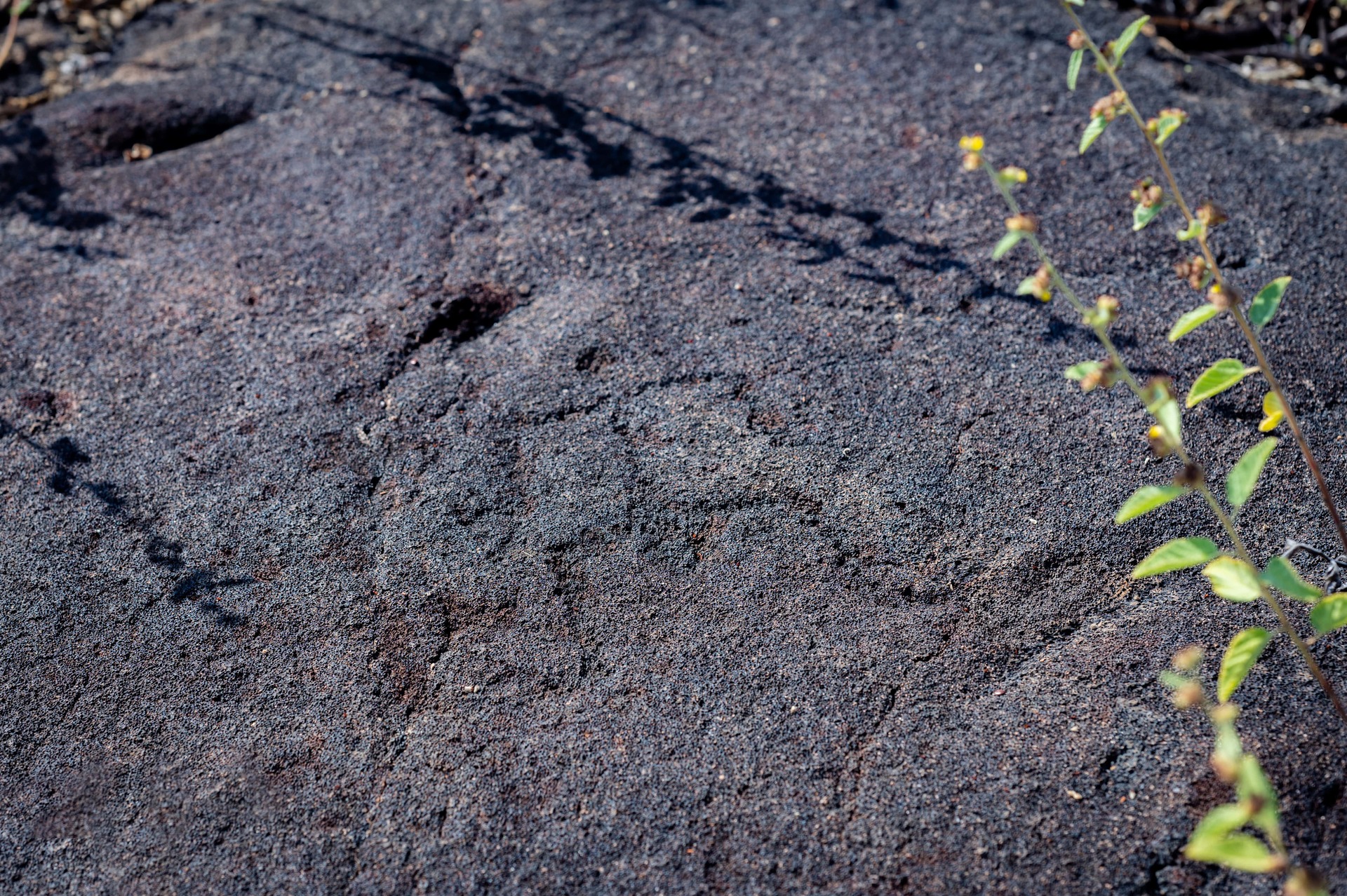
There are several other historical features in the park that are exciting to see still in existence, including many petroglyphs and a portion of the Ala Mamalahoa, also known as the King’s Highway, a walking path that covered large distances, allowing for the movement of official government business as well as commerce, and would be considered the safest route for travel. One of the park’s most significant features, though it has yet to be proven, is that it is one of the locations thought to be the burial place of King Kamehameha, the chief who united all of the Hawaiian Islands under one rule. The choice to be buried somewhere amongst the sea caves, along with other ali‘i demonstrates the spiritual, cultural and historical significance of the park.
Despite all of these historical facets, this area was once in danger of being developed for tourism and housing purposes. Surveys were done, and in the 1970s during the Hawaiian Renaissance, an advisory group petitioned the United States Department of the Interior to add the area to the National Park Service. In 1978, the park was created, and this section of the Big Island has and will remain in perpetuity a protected piece of important history. No matter your reasons for visiting, whether to see the honu, the fishponds, the beautiful beaches, or the quiet tranquility of the place, go see for yourself the power of this special land. There you will find a lovely corner of our island, hidden in plain sight and open to all who wish to better know Hawai‘i and its people.
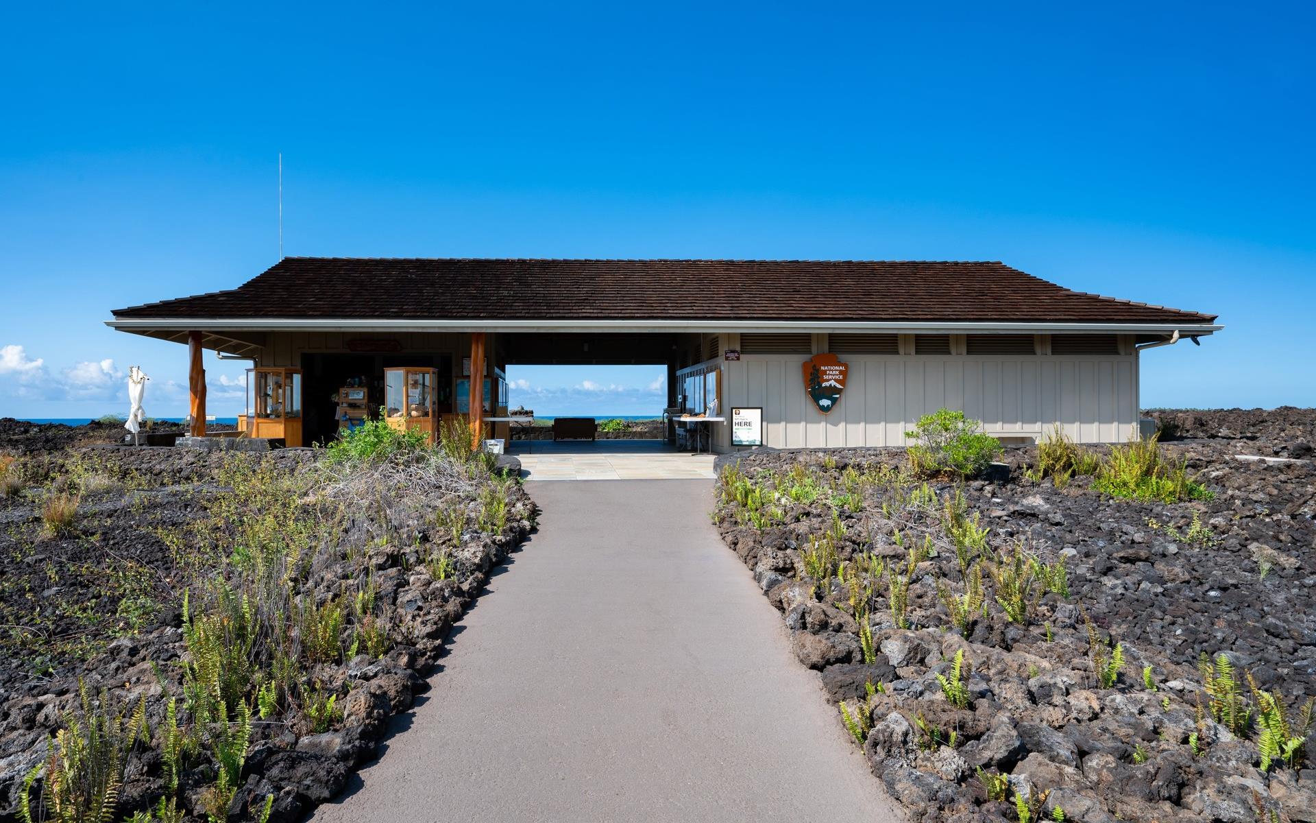
Kaloko-Honokōhau National Historical Park is located along the Queen Ka‘ahumanu Highway in Kailua-Kona, near Costco and Honokōhau Harbor. The park visitor center is open daily from 8:30 a.m. until 4:00 p.m., and all cars must be removed from the parking lot by 4:00 p.m. The road to Kaloko pond is open from 8:00 a.m. until 5:00 p.m. daily. Visit the National Park website at nps.gov/kaho for more information and to learn more about the founding and significance of the park by reading “The Spirit of Kaloko-Honokōhau.”